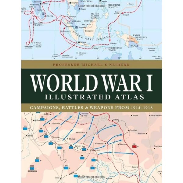
WORLD WAR I ILLUSTRATED ATLAS
192
твърда
английски
2023
19.11.2023 г.
20876354
9781838863548
With a new cover design and updated introduction, this complete atlas provides an invaluable work of reference for both the general reader and the serious student of World War I.
World War I Illustrated Atlas is a comprehensive visual guide to this complex conflict. In fine detail, it plots the exact course of the land, sea, and air campaigns, enabling the reader to trace the ebb and flow of the fortunes of all sides. With more than 180 full-color maps, every theater of war is covered—from the Western Front to Penang, from Gallipoli to Galicia, from Dogger Bank to Dalmatia, from Romania to Rhodesia, and from the Falklands to Togo and the Sinai desert. All the maps have been specially commissioned from an expert cartographer. Each map is designed to highlight a particular aspect of the war—thus maps vary in shape and size, with some giving a global perspective while others depict the exact movement of armed forces on land, sea, or in the air. Battles such as Jutland, the Somme, Cambrai, and the Gallipoli campaign are shown in great detail. All maps are accompanied by an explanatory key.
Категории
Вие оценявате:

Вашите заявки се обработват всеки работен ден от 9,30 до 18,00 ч.
Направени до 16,00 ч. поръчки за страната и чужбина се предават на куриерска служба в рамките на 3 работни дни или според графика за обслужване на съответното населено място.
За страната Книгомания работи само с куриерска служба „Спиди".
Доставките за София на наличните заглавия се изпълняват от куриер на Книгомания в рамките на два работни дни.
Доставката в рамките на страната е 1.99 €
При поръчки на стойност над 25.05 € доставката е безплатна.
Всички цени на Продуктите или Услугите са крайни, обявени са в евро (EUR) с включено ДДС и всички други изисквани данъци или такси, без цена за обработване и доставка, която е посочена отделно, в случай, че такава се дължи.
1 EUR е равно на 1.95583 лева.
Приемат се плащания с наложен платеж, чрез e-Pay и PayPal.